by northcrek | Dec 29, 2020
Hey Days Restaurant – Pizza, Wings, More!
Sunday- Tuesday closed
Wednesday 3:30 – 7:00 pm
Thursday 3:30 – 7:00 pm
Friday – 12:00 – 8:00pm
Saturday – closed
Hey Days Restaurant267 Main Street, North Creek, NY 12853518-251-4448 | Website 
Hey Days Restaurant
Hey Days Restaurant
267 Main Street, North Creek, NY 12853
518-251-4448 | Website

by northcrek | Apr 19, 2020
Camping – Primitive Camping 13th Lake and Garnet Lake

 Camping in the North Creek Area is blessed with a 114,000 acre state designated wilderness area called The Siamese Ponds Wilderness. Wilderness is the strictest land use regulation in the Adirondack Park with a blanket prohibition on motorized use of any kind. There is however over 75 miles of marked trails lots of backcountry ponds, lean-to camps and primitive campsites. 13th Lake is the gateway to the area and has 11 campsites on it’s shores. The 2 campsites at the parking area off Beach Road are quite popular especially on weekends. All camping is first come, first served. No reservations are allowed. Primitive Camping Regulations/Info
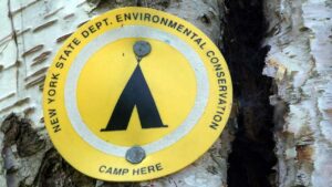
Use the map here or the interactive map below – look for the “Camp Here” sign to set-up your campsite. More Hiking Info Here. Regional Office, Warrensburg, NY (518) 623-1200. Camping longer than 3 days require a permit from the local Ranger – Art Perryman – (518) 897-1303.
Rescue and Emergencies – call 518-891-0235 or Dial 911
Map of Siamese Ponds Wilderness campsites 13th Lake and lean-to Wilcox Lake Wild Forest Map, Camping Garnet Lake
The 13th Lake camping is not true “automobile camping” but the state of NY administers a large number of automobile campsites in the Adirondack Park – the closest ones to North Creek are Lake Durant and Lewey Lake to the North and Lake George area campsites to the South. See the complete list – interactive guide here.
Click the Map to Activate Controls 13th Lake Area Camping
Click the Map to Activate Controls Garnet Lake Area Camping
13 Lake Trailhead, Beach Road, North River
13 Lake Trailhead
Hiking Trail access, campsites and boat launch
Garnet Lake Boat access site
Garnet Lake Boat Access
And Campsites

by northcrek | Oct 5, 2019
 Blue Ledge on The Hudson River
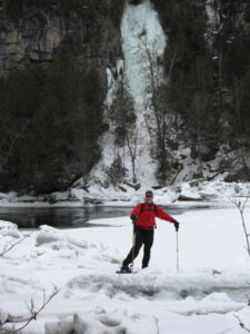
Blue Ledge on The Hudson River – The Blue Ledge Pool is the popular lunch stop for whitewater rafting trips on the Hudson. Foot trail access is via the Northwoods Club Road off Rt. 28N in Minerva. Drive all the way into Huntley Pond where you’ll see a “Trail To” sign and a small parking lot. Blue Ledge gets it’s name from the blue/grey rock forming the ledges. In winter this forms a large ice fall and the Blue Ledge is a great destination for snowshoers or backcountry skiers. The hike in about 3 miles and is not difficult. More Hikes Here
Printable Map of Blue Ledge TrailTrailhead Directions CLICK HERE
Click the Map to Activate Control
Blue Ledge Trail Head, Huntley Pond, Northwoods Clud Road, Minerva
Blue Ledge Trail, 3.5 miles to the Hudson River
Huntley Pond

by northcrek | Jun 20, 2019

by northcrek | Jun 16, 2019
Trail Run Project From REI – Interactive Map
Trail Information Links will leave the website.
Click the Map to Activate Controls
